Services
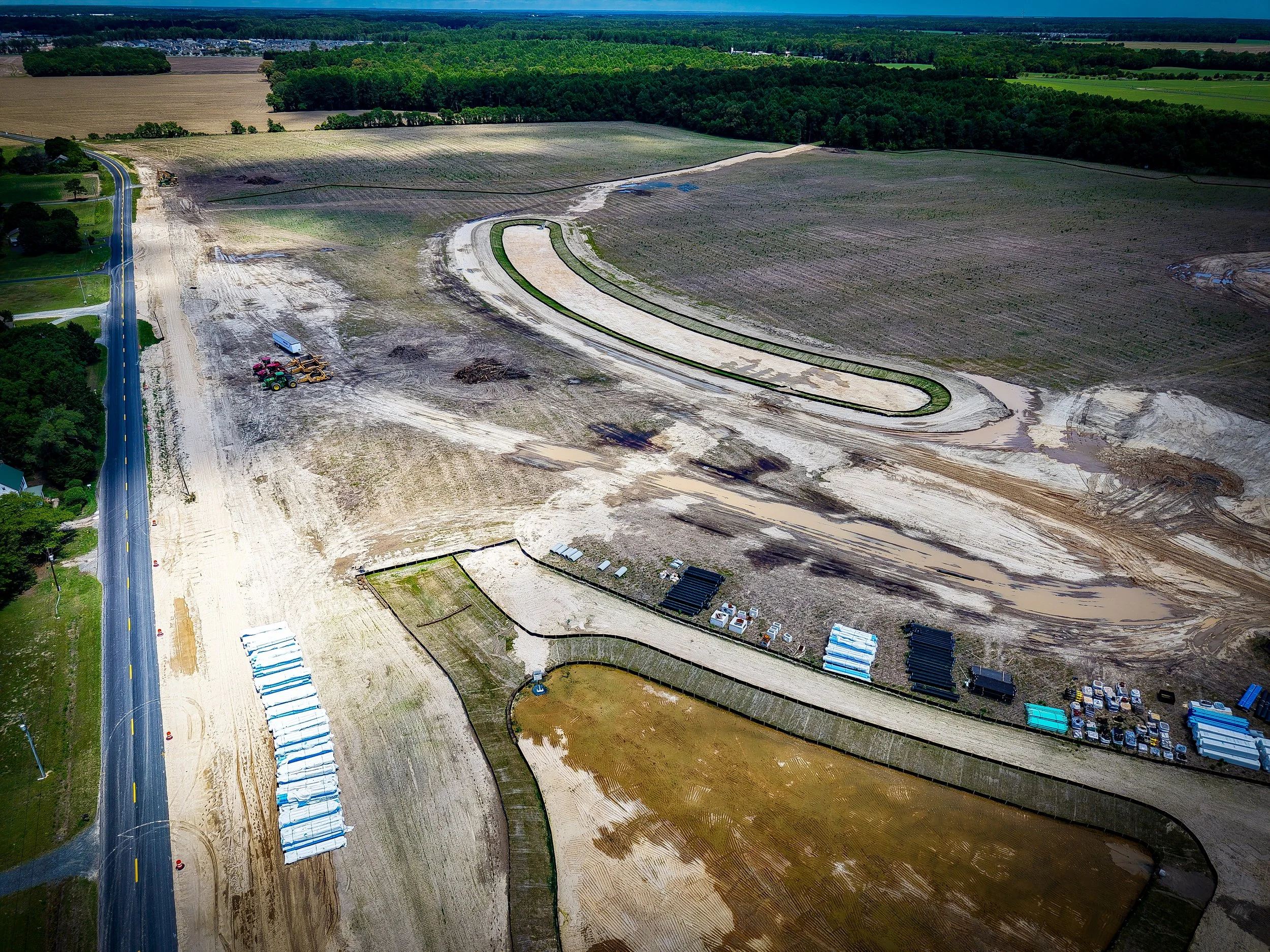
Construction
Drone services bring a powerful advantage to construction projects by delivering high-quality aerial imagery, progress tracking, and site mapping. With fast, accurate data collection, project managers can improve efficiency, ensure safety, and keep stakeholders updated every step of the way.
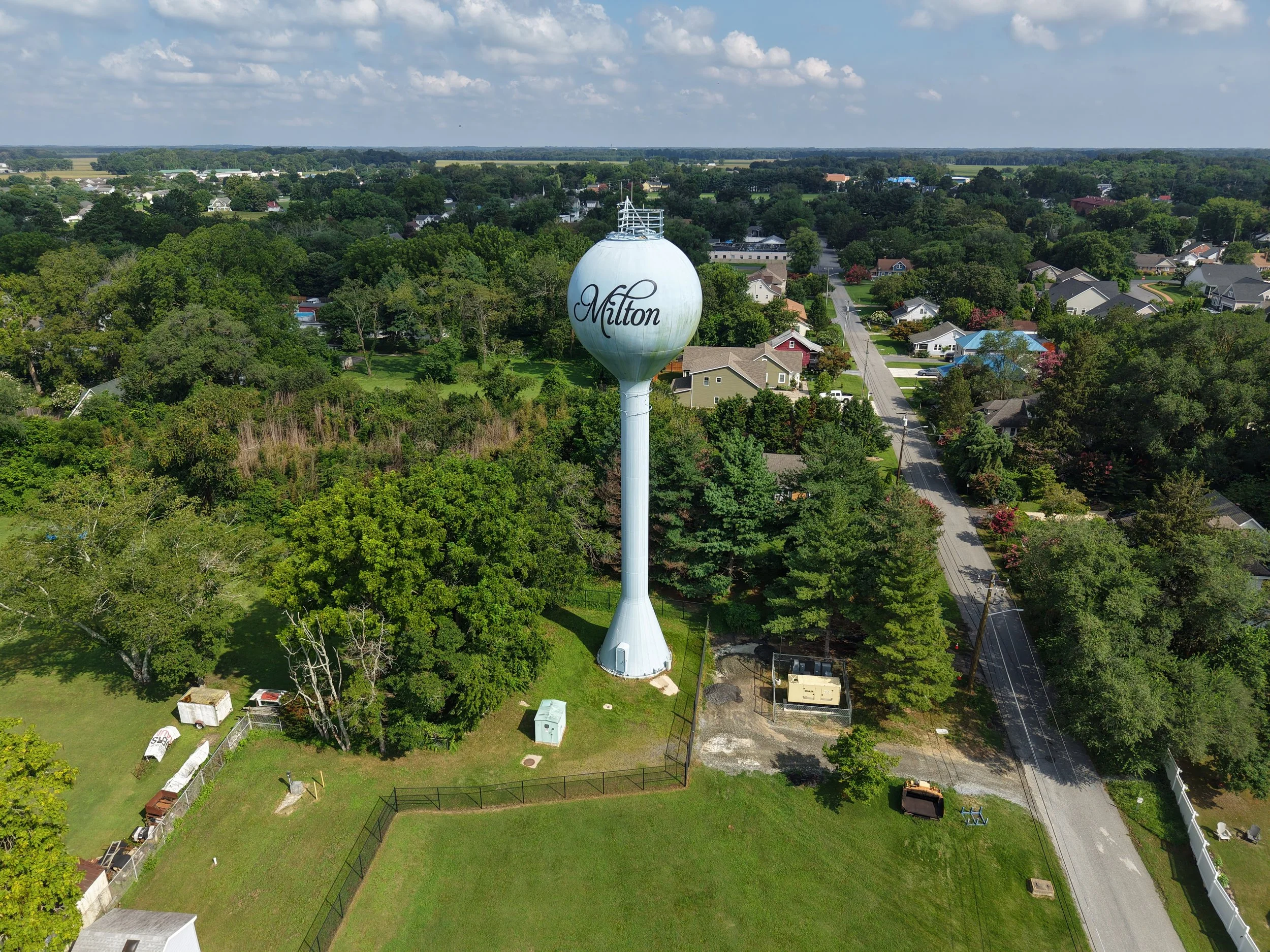
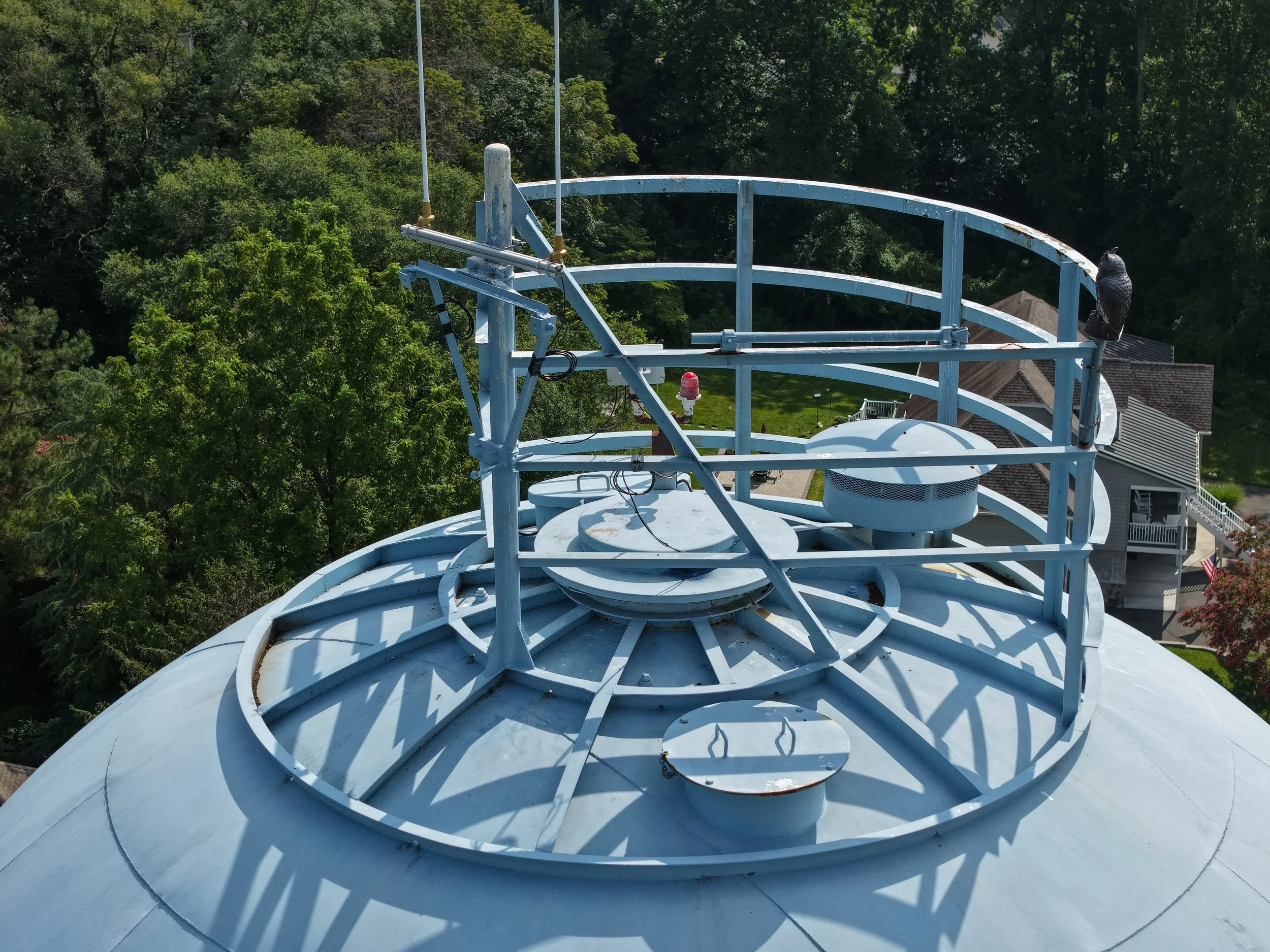
Tower Inspections
Drone services make tower inspections safer, faster, and more cost-effective by eliminating the need for risky climbs and costly equipment. High-resolution aerial imagery and detailed reports allow for accurate assessments, early detection of issues, and reduced downtime — all while keeping technicians safely on the ground.

Marketing Material
Drone footage gives marketing teams a powerful way to showcase projects, properties, and events with stunning aerial perspectives that capture attention instantly. High-quality video and imagery highlight scale, progress, and unique features in ways traditional photography can’t, making content more engaging for websites, social media, and promotional campaigns. By offering dynamic visuals that stand out, drone footage helps brands tell compelling stories and connect with their audience on a whole new level.
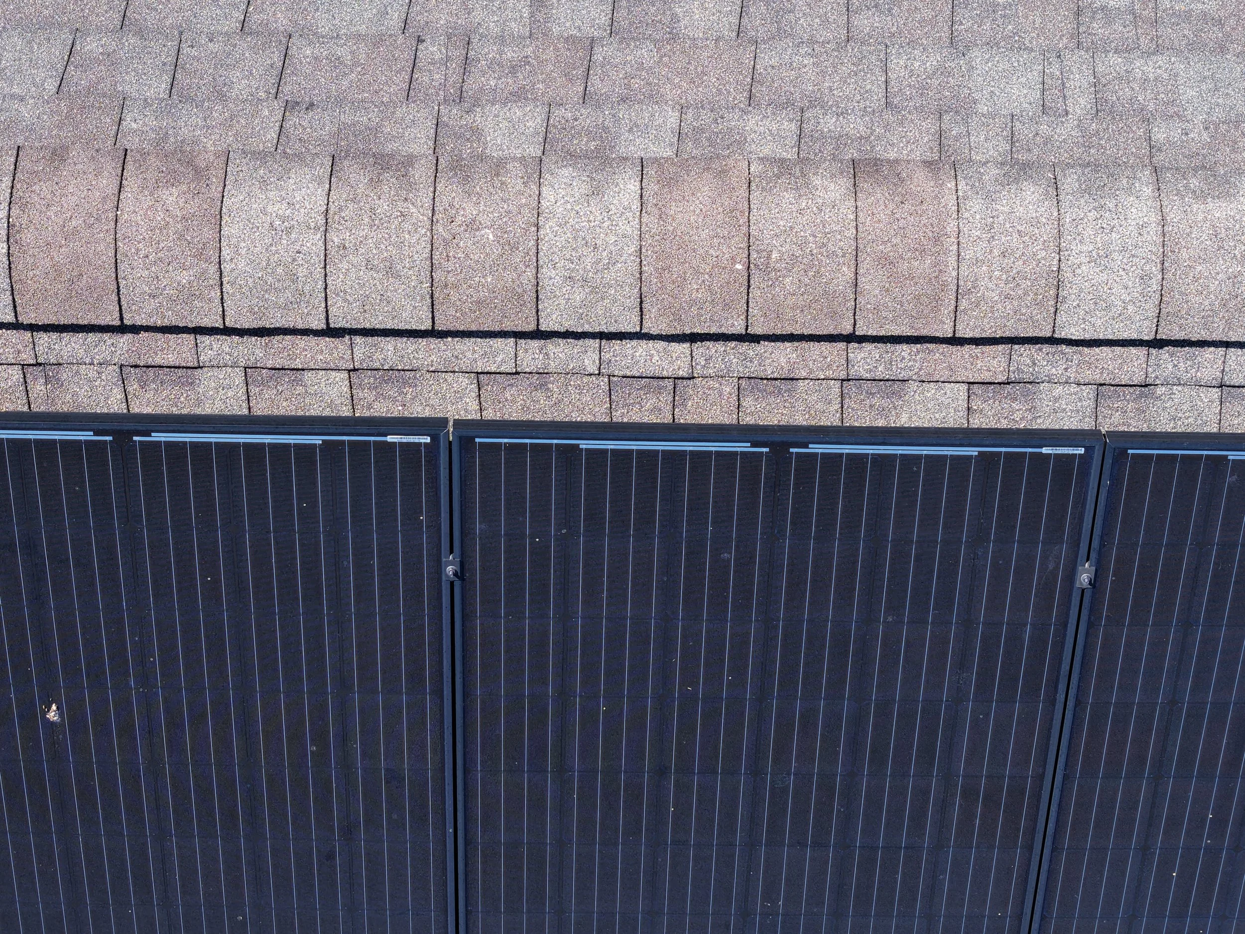
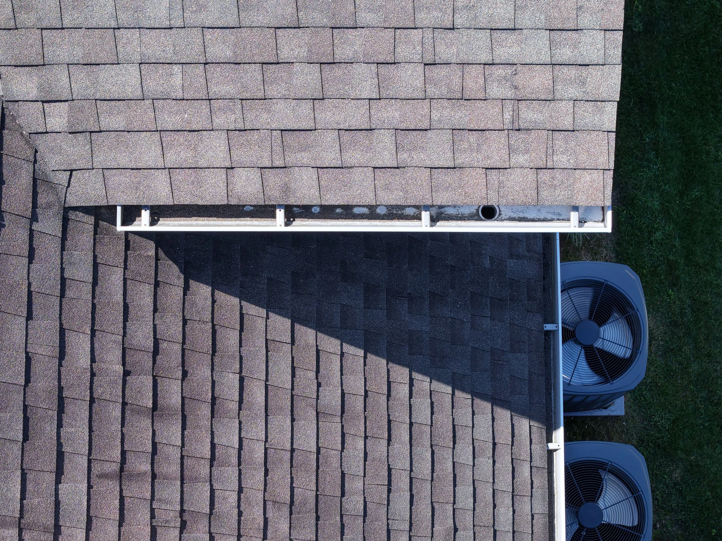
Roof Inspections
Drone inspections provide a safe and efficient way to assess roofs, gutters, and solar panels without the need for ladders or scaffolding. High-resolution imagery and thermal scanning help detect damage, leaks, or performance issues quickly, saving time and reducing costs. With fast, accurate results, property owners and managers can make informed decisions while keeping workers safely on the ground.

Commercial Real-estate
Drone imagery gives commercial real estate a competitive edge by showcasing properties with high-quality aerial views that highlight location, scale, and surrounding amenities. Prospective buyers and investors gain a clear perspective of building layouts, parking, access points, and nearby infrastructure — details that standard ground photos often miss. By presenting properties in a more dynamic and engaging way, drone imagery helps listings stand out, attract more interest, and accelerate decision-making.

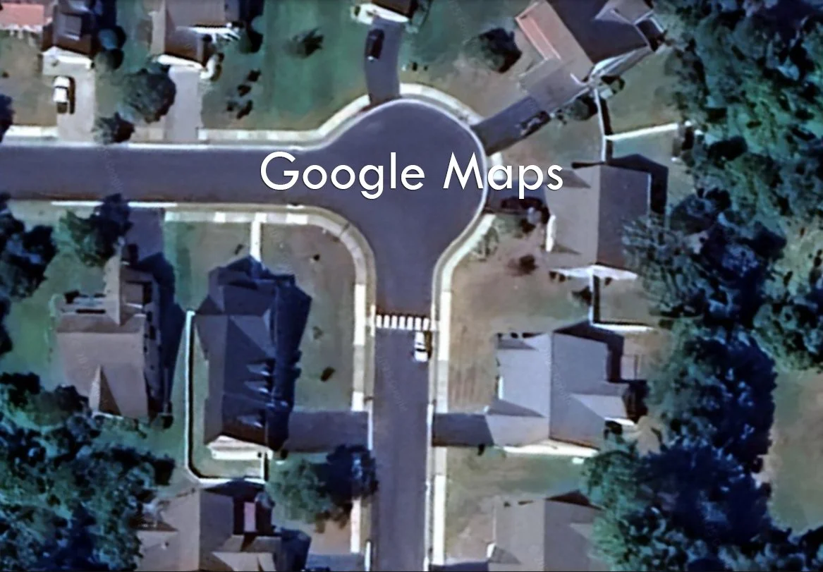
Mapping
Unlike the low-resolution and often outdated imagery from Google Maps, drone mapping delivers up-to-date, high-resolution aerial data tailored to your exact site. With precise 2D and 3D maps, you gain accurate measurements, detailed visuals, and real-time insights that free mapping tools simply can’t provide. This allows for better planning, monitoring, and decision-making across construction, agriculture, and land development projects.